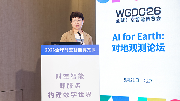
On the morning of May 21st, at the "AI for Earth: Earth Observation Forum" forum of the "Global Spatio Temporal Intelligence Expo" (WGDC2026), Meng Shuying, an outstanding engineer of the National Energy Group, chief engineer of the Beidou Spatio Temporal Operation Center, and chief expert of the Digital Intelligence Technology Company, stated that energy companies highly rely on spatiotemporal information in various stages, including construction and operation, production and operation, logistics and transportation, as well as safety emergency response, land environmental protection, resource assets, etc. This also means that under the coordinated development of artificial intelligence and energy ecology, spatiotemporal information services will inevitably move towards scenario based and intelligent development. The National Energy Group will comprehensively build Energy Space 2.0 from 2026 to 2027, ushering in a new era of energy space and time.
According to her introduction, the National Energy Group has a wide range of energy production categories, a large scale, and a wide distribution range, with strong industry representativeness. At the same time, it has built a comprehensive supply chain from primary energy to secondary energy, covering sectors such as "coal, electricity, ports, and shipping", forming an integrated operation advantage of the entire industry chain of "coal, electricity, oil, and gasification" and "production, transportation, sales, storage, and use". Taking the business needs of the group as an example, we have comprehensively sorted out the business application scenarios around the four major business areas of coal, electricity, chemical industry, and transportation, and deepened the comprehensive spatiotemporal promotion of Beidou, remote sensing monitoring, and meteorological services.
Meng Shuying emphasized in her speech the National Energy Time Space Intelligent Service System, which includes "one map, one network, one platform+a series of terminals". She explained that "Yitu" is a national energy map, mainly based on basic surveying and mapping data, multi period remote sensing data, integrating natural resources (Ministry of Natural Resources), meteorological spatiotemporal (National Meteorological Administration), Beidou spatiotemporal, environmental monitoring and other data, gathering production and operation data from more than 3000 grassroots units of the group company, and providing PaaS and SaaS services for different information/business system applications. One Network "refers to the high-precision spatiotemporal network of Guoneng, including high-precision location network and time-frequency service network. The Guoneng Spatiotemporal Information Platform integrates basic geographic data and production and operation data into two categories and seven subcategories of spatial-temporal data, providing six categories of spatial-temporal services including maps, locations, integrated communication, meteorology, remote sensing, and time-frequency. It realizes the integrated application of Beidou communication navigation positioning, spatial-temporal computing, remote sensing meteorological monitoring and early warning.