On June 10th, Wuhan University officially announced the first enrollment of students for the Time Space Information Engineering major in 2025, making it the first time in the country to specialize in this field.
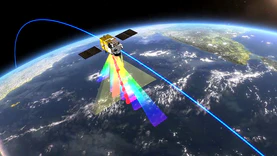
As a new interdisciplinary major established by the Ministry of Education in 2025, the Spatiotemporal Information Engineering major deeply integrates cutting-edge technologies such as aerospace technology, electronic information surveying and remote sensing, artificial intelligence, etc., to achieve spatiotemporal perception and intelligent analysis of the sky, earth, and sea, and cultivate composite talents with interdisciplinary perspectives and innovative abilities.
Wuhan University stated that its first spatiotemporal information engineering major in China is backed by the Surveying and Mapping Science and Technology major, and has been continuously rated A+in disciplinary evaluations, consistently ranking first in the country.
In terms of faculty configuration, Academician Li Deren (dual academician) leads the intelligent processing of spatiotemporal information, Academician Liu Jingnan leads the research and development of the Beidou Navigation System, Academician Zhang Zuxun creates a new paradigm of real-time 3D modeling, Academician Li Jiancheng deeply cultivates high-precision spatiotemporal benchmarks, Academician Gong Jianya is in charge of remote sensing big data analysis, and there are 120 full-time teachers, including 58 professors and nearly 30 national level talents (including dual employment).
The core courses of this major include "Principles and Methods of Spatiotemporal Benchmarking", "Error Theory and Optimal Estimation", "Principles of Spatial Positioning and Navigation", "Principles and Applications of Remote Sensing", "Principles of Geographic Information Systems", "Spatiotemporal Big Data Analysis", "Artificial Intelligence and Machine Learning", etc.
The spatiotemporal information engineering major relies on national key laboratories and national engineering technology research centers to carry out cutting-edge research such as Beidou navigation, intelligent driving satellite remote sensing intelligent processing, spatiotemporal big data analysis, etc. It collaborates with enterprises such as Huace Navigation and Dongfeng Motor to establish joint laboratories and internship bases. Graduates' employment directions mainly cover government departments and institutions such as aerospace, natural resource emergency management, and smart cities, as well as technology enterprises such as high-precision maps and navigation positioning such as Huawei, Baidu, Tencent, Alibaba, DJI, and Gaode.
On April 22, the Ministry of Education released the results of the registration and approval of undergraduate majors in ordinary colleges and universities for 2024, and added majors such as spatiotemporal information engineering to serve national strategies. Spatiotemporal Information Engineering belongs to the surveying and mapping major, with a basic study period of four years, and is awarded a Bachelor of Engineering degree.


