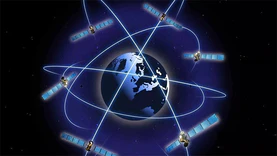
Carry out key technological breakthroughs such as comprehensive PNT, spatiotemporal big data, and Beidou fusion applications, and jointly build the Beidou spatiotemporal industrial ecosystem in the Beijing Tianjin Hebei region.

Or provide direct equity investment support of 30% of the total share capital of the project, up to a maximum of 100 million yuan.

Support cities such as Jinan, Qingdao, Dongying, Yantai, Linyi, and Binzhou to take the lead in opening B2B and B2C logistics delivery routes using drones.

By 2027, build one general aviation airport and over 200 vertical takeoff and landing sites/points.

We should explore the construction of an intensive deployment model of "one place construction, multiple places and departments reuse", coordinate the promotion of the deployment and application of government models, and prevent the formation of "model islands".

For innovation platforms that have been upgraded to national level and do not have supporting funding requirements from the government, a funding support of 10 million yuan will be provided according to regulations.

The maximum reward shall not exceed 30 million yuan

Build a development pattern of "three cores, three zones, one corridor, and multiple nodes".

Accelerate the construction of low altitude information infrastructure.

Support the creation of a spatiotemporal data base.

The maximum amount shall not exceed 10 million yuan.

The maximum subsidy is 10 million yuan.

Select and publish 40 excellent cases of immersive experience new spaces for smart tourism.

Intelligent connected vehicles should use the national unified Beidou satellite navigation and positioning reference service system when conducting surveying and mapping activities.

Draw a product map of low altitude equipment in Shaanxi Province.

By 2027, cultivate no less than 10 pilot projects for immersive experience new spaces in smart tourism, and cultivate no less than 10 top tier popular tourism products.

Other data application providers such as image merchants and car companies carry out various applications in the compliance cloud area.

Promote the construction of digital twin watershed and digital twin Guangzhou water network.

Reduce the cost of computing power usage.